
Stone summit marker reading Ryozen 610m, Oita City forest therapy, on an open hilltop in Oita
Step-free
Partly step-free
Two built stretches, assistant assumed
The main road
Takasaki-yama
高崎山 · 3 km (1.9 mi) one way · 1 hour
Open
Year-round
Colour into early December
The record
What you need to go
Open season
Open year round. Violets and small gentian from late February, forest air 2 to 4 °C (4 to 7 °F) cooler in summer, color into early December
Getting there
No station or bus route published. Most roads are 30 minutes to an hour by car from the city center, so you need one
Fees
A guide is ¥3,000 (about $20) per group of up to five, for two to three hours. The roads carry no fee, and there is no therapy bentō
Onsen
not published
The walk
Main trail
Takasaki-yama (高崎山), 3 km (1.9 mi) one way in an hour, climbing 280 m (919 ft) past castle ruins to views over Beppu Bay
All trails
10 trails, 1.5 to 6 km (0.9 to 3.7 mi), 50 minutes to two hours, climbing 50 to 480 m (164 to 1,575 ft)
The step-free road
Two stretches are built for wheels, 0.8 km (0.5 mi) on the Ryōzen road and 0.9 km (0.6 mi) at Oshidori gorge, both with slopes and wooden bridges, and an assistant assumed
The forest
Forest type
Half the city’s land is forest. Ten separate woods, from a paved loop beside an art museum to a ridge the guides rate five stars
What grows
Cedar · Hinoki cypress · Red pine · Sawtooth oak · Konara oak · Arakashi oak, plus the holtonoki
What lives
Japanese macaques on Takasaki-yama, if you are lucky. Varied tit, Japanese tit and pygmy woodpecker in winter, bush warbler in spring
Certified since
2012
All figures updated 5 October 2026
The forest, before the facts
On the mountain at the edge of Ōita city, the one that looks out over Beppu Bay, there are monkeys. Not a sign saying monkeys, not a picture of a monkey on a souvenir: the animals themselves, in the trees, on the path. The Forest Therapy Society says, with admirable restraint, that if you are lucky you may meet them.
Above the monkeys, near the summit, you can see what is left of Takasaki castle (高崎城), a medieval mountain stronghold of the Ōtomo family. Below, the Society says, is the whole sweep of Beppu Bay, Kunisaki, and the peaks of Yufu and Tsurumi.
And that is one road of ten. Ōita is a city that has certified ten separate forests within an hour of its center, from a flat loop beside an art museum to a mountain its own guides rate at five stars for difficulty. You can stay in a city hotel, take a different forest every morning for a week and a half, and never repeat yourself.
Five reasons to come
Wild monkeys on a mountain above Beppu Bay.
Ten certified roads, all within an hour’s drive of the city center.
A guide for up to five people at ¥3,000 (about $20) a group.
Two short stretches built for wheelchairs, with a stated welcome for blind and deaf walkers.
Forest air the Society says runs 2–4 °C (about 4–7 °F) cooler than town.
A city with ten forests
The Society’s tagline for Ōita is the mountain compass of Ōita, and its introduction explains why. The city sits on the eastern edge of Kyushu, with Takasaki-yama (高崎山), Ryōzen (霊山), Yoroigatake (鎧ヶ岳) and Momikiyama (樅木山) among its mountains, and half its land in forest. The Ōno and Ōita rivers (大野川, 大分川) run north to south through it.
The guides’ own message puts the point in one line: drive thirty minutes to an hour from the city, and you are standing in real forest, on one of ten therapy roads. That is the base’s whole proposition. It is not a resort or a pilgrimage town. It is a city that has measured the forests around it and certified ten of them.

The cedar belt on the north face, which keeps the climb shaded most of the way.
The Society’s list gives each road a distance, a time, and a height difference, and the spread is wide. The shortest is Ueno no Mori (上野の森), a 1.5-kilometer (0.9-mile) loop in 50 minutes with a 50-meter (164-foot) rise. The longest is Oshidori gorge (おしどり渓谷), 6 kilometers (3.7 miles) one way in two hours, with a 200-meter (656-foot) drop. The steepest is Uso-zan (宇曽山), 2.5 kilometers (1.6 miles) one way in an hour and twenty minutes, with a rise of 480 meters (1,575 feet).
All ten, in the Society’s figures
If you are planning a week, here are the rest. Takasaki-yama (高崎山), 3 kilometers (1.9 miles) one way, an hour, 280 meters (919 feet). Ryōzen (霊山), 1.8 kilometers (1.1 miles) one way, an hour, 275 meters (902 feet). Heisei Forest Park (平成森林公園), a 3-kilometer (1.9-mile) loop, an hour, 50 meters (164 feet).
Yoroigatake (鎧ヶ岳), 2.7 kilometers (1.7 miles) one way, an hour and a half, 200 meters (656 feet). Tenmen-zan (天面山), a 2-kilometer (1.2-mile) loop, an hour, 100 meters (328 feet). Hongū-zan (本宮山), a 3.5-kilometer (2.2-mile) loop, an hour and a half, 215 meters (705 feet). Mominoki-yama (樅の木山), 2.2 kilometers (1.4 miles) one way, an hour, 270 meters (886 feet).
The city’s own site adds a difficulty rating to each, from one star to five.
The flat loop at Ueno no Mori gets one star. Yoroigatake gets five. Uso-zan and Mominoki-yama get four. Most of the rest sit at two or three.
That rating scale is worth having, because the Society’s distances alone do not tell you what a road is like. Its figures make Yoroigatake look middling, at under 3 kilometers (1.9 miles). The city’s guides give it their highest rating.
The monkey mountain
Takasaki-yama (高崎山) is the road most visitors will know by name. The Society describes it as the mountain famous for its monkeys, with a path toward the summit that passes the ruins of the castle, and views over Beppu Bay, Kunisaki, and the peaks of Yufu and Tsurumi.
The city’s site gives three ways up. From the Zenibin pass (銭瓶峠) parking lot, it is about an hour and a quarter one way. From Tanoura Beach (田ノ浦ビーチ), the beach park on the bay, or from Yusuhara Hachiman shrine (柞原八幡宮), it is about two hours and a quarter. There are two bio-toilets at the south trailhead.

Planted close and thinned late, which is why so little light reaches the floor.
The city’s description of the summit is specific: near the top, it says, you can see the remains of Takasaki castle, the medieval mountain castle of the Ōtomo family. The Society’s road list gives the path a 280-meter (919-foot) height difference.
The animal is the Japanese macaque (ニホンザル), and the Society is careful to keep the promise conditional. If you are lucky, it says, you may meet them. Treat that as a forecast, not a booking.
The reservoir forest
Oshidori gorge (おしどり渓谷) is the road for a long, easy day. The Society says it was laid out in the prefectural people’s forest (県民の森), which it describes as the second largest of its kind in the country, with courses beside an artificial lake and along streams, and seasonal flowers. It calls the paths easy to walk.
The city’s site breaks the area into three courses, a satoyama forest course, a waterside forest course, and a cycling-road course, and names the Sonoda river (園田川), the artificial lake, and the gorge itself. It mentions shelters at the halfway point and at the Yasutomo garden (安友庭園), log benches through the gorge, and a route past Ōhira shrine (大平神社).
Here the two sources disagree on time. The Society gives the road as 6 kilometers (3.7 miles) one way in two hours. The city gives about an hour and ten minutes going down and about an hour and a half coming up, with no distance.
The practical details are the city’s. There is parking, which it says must be reserved in advance, and there are toilets. The prefectural forest’s management office is closed on Tuesdays and locks the parking lot at five, on 097-588-0656.
The temple mountain
Ryōzen (霊山) is the road that begins at a temple. The city’s site gives two routes: from Ryōzen-ji (霊山寺), through its mountain gate, about an hour one way; or from the south trailhead, about twenty-five minutes.
On the temple route it lists the landmarks in order: a stone inscribed with a poem, a bell tower, a lookout, a pond named for the goddess Benten, a fourth station, a stone figure of the horse-headed Kannon, and the summit. The forest it describes is natural woodland and hinoki plantation, with views from the lookouts.

Roots and trail competing for the same ground, and the roots are winning.
The Society’s figure for the same road is 1.8 kilometers (1.1 miles) one way in an hour, with a rise of 275 meters (902 feet). The city’s twenty-five-minute south route is a different way up the same mountain, which is why the two times are so far apart.
The flat road and the elephant
At the other end of the scale is Ueno no Mori, the forest at Ueno. The Society describes it as close to the city center, and says the far end of the road has an art museum and a plaza with a large elephant sculpture.
The Society’s list names the museum among the base’s nearby facilities: the Ōita City Museum of Art (大分市美術館), with a permanent collection and special exhibitions for all ages. It also lists Tanoura Beach (田ノ浦ビーチ), a beach park on Beppu Bay where you can swim in summer.
The Society’s figures for Ueno are a 1.5-kilometer (0.9-mile) loop in 50 minutes, with 50 meters (164 feet) of rise. The city’s guides give it one star and an hour.
The city’s own page for the road splits it in two. The Ueno course, about fifty minutes there and back, starts from the former park management office; a shorter children’s forest course, about twenty-five minutes, starts from the parking lot of the Uenooka children’s forest park (上野丘子どものもり公園). The city describes the woods as evergreen broadleaf forest, the paths as mostly paved, and a view of Takasaki-yama and the city from the higher points.
The hard one
Yoroigatake is the road the city’s guides rate at five stars, and its own page says why. It calls the course a repeated cycle of hard climbs and descents and gentle ridge walking, for strong walkers. It also warns that the road is somewhat demanding and needs proper preparation.
The route the city describes starts at the Yotsutsuji pass (四辻峠) trailhead and climbs steep steps to Amagoi-dake (雨乞岳), then follows a ridge through hinoki and mixed woods to Eboshi-dake (烏帽子岳), then drops down more steep steps to a gentle ridge path through red pine to Yoroigatake itself. It puts a figure in meters beside each leg: 400, 1,500 and 800 — about 1,300, 4,900 and 2,600 feet. Those three figures add up to exactly the Society’s 2.7 kilometers (1.7 miles) for the road, so they read as distances along the path rather than heights.

From 610 meters the whole Oita plain is laid out, with Yufu behind it.
To reach the trailhead, the city says to take Prefectural Road 26, from either Route 442 or Route 57, and drive about twenty minutes uphill. There is parking and a toilet. It gives the round trip as about two hours, where the Society’s road list gives an hour and a half one way.
Blackflies, and a view to Shikoku
Uso-zan (宇曽山), the steepest road by the Society’s figures, carries the one practical warning you will be glad of. The city’s page says that blackflies (ブヨ) come out on the climbing path in summer, and that insect repellent is a good idea.
The page gives two routes. Up the climbing path, which it also calls the approach, takes about an hour and twenty minutes; down the forest road takes about an hour and ten. From the parking lot at the end of the forest road it is fifteen minutes to the summit, and the city says both the lot and the summit have good views. At the foot is Uso Sansō (宇曽山荘), a lodge the page says sells light meals, lunchboxes, and bread.
Mominoki-yama (樅の木山) has the best-promised view. The city says it is an ideal hiking course, and that from the top you can see as far as Shikoku. It gives about fifty minutes one way from the trailhead and about an hour and forty from the foot of the mountain.
What the certificate measured
Ōita publishes which tests were run. The city’s about page says physiological and psychological experiments were carried out in 2011, and lists the measures as heart rate variability, cortisol, salivary amylase activity, blood pressure, and heart rate.
It does not publish the results, the number of people tested, or which of the ten roads they walked. Those are the questions the certificate does not answer.
The same page dates the certification to March 2012, and calls Ōita the first forest therapy base and therapy road certified in the prefecture. The Society says April 2012. Take your pick; the year is not in doubt. The page also puts the city’s population at about 480,000.
Two stretches built for wheels
Ōita answers the Society’s barrier-free question positively, and the city’s own site explains what it means by that. Some of its therapy roads, it says, include paved gentle paths alongside the mountain trails, and wheelchair users, and people with visual or hearing impairments, can enjoy them together with someone to assist.
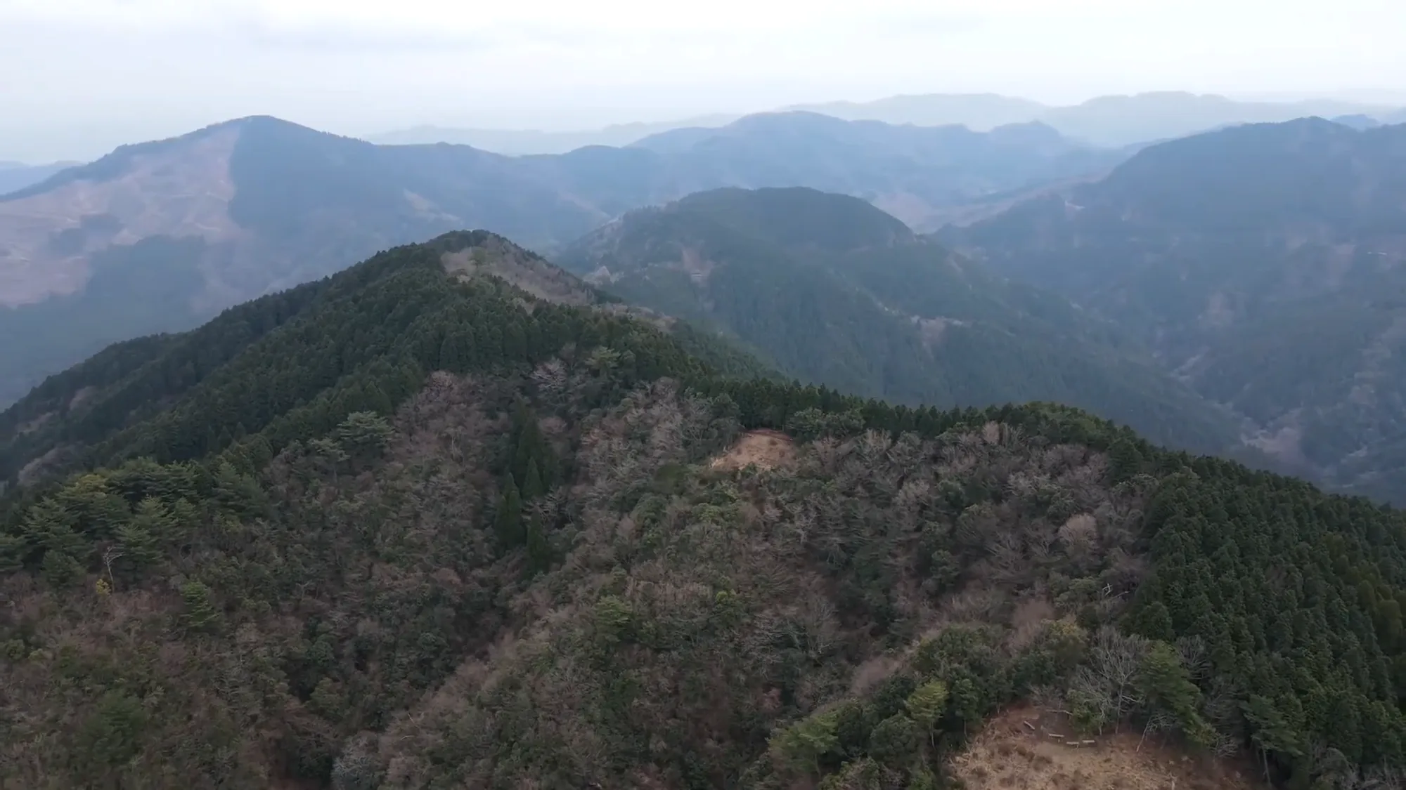
Ridge behind ridge, all of it wooded, none of it flat.
The site names two specific stretches. On the Ryōzen road, about 0.8 kilometers (0.5 miles), roughly twenty minutes, includes somewhat steep slopes up to viewpoints over the city. At Oshidori gorge, about 0.9 kilometers (0.6 miles), roughly twenty minutes, goes around the artificial lake with continuing slopes up to a shelter. It warns users to take real care on the steep slopes and on wooden bridges.
That is more honest than a single word, and it is still not enough to plan with.
Ask the city four things. How wide is the surfaced path on each stretch, in centimeters?
Is there a step where it begins? What is the surface between the parking lot and the start? And is the toilet at each trailhead accessible to a wheelchair?
What lives here
The Society’s seasonal notes for Ōita are unusually specific about animals, and they put them in winter. The winter entry is three birds: the varied tit (ヤマガラ), the Japanese tit (シジュウカラ) and the Japanese pygmy woodpecker (コゲラ).
The city’s roads page names two more: the Japanese macaque (ニホンザル) for Takasaki-yama, and the Japanese bush warbler (ウグイス).
Then there is the name that is not an animal. Oshidori gorge means the gorge of the mandarin ducks, though neither the prefecture nor the city will promise you a duck.
The seasons, by the Society
The Society’s seasonal notes are unusual in giving dates. In spring, violets and the small gentian called harurindō (ハルリンドウ) appear from late February. In summer, the air in the forest is two to four degrees Celsius (about four to seven degrees Fahrenheit) cooler than in town, and there is river trekking.

In winter the leaves go and the bay turns up.
In autumn, the beech, two maples and komayumi (コマユミ) turn, and the Society says the color lasts until early December. In winter, there are the three small birds.
The Society’s tree fields list cedar, hinoki, and red pine as the conifers; sawtooth oak, konara oak, and arakashi oak as the broadleaves; and one special tree, the holtonoki (ホルトノキ). It does not say where on the ten roads the special tree grows.
Guides, prices, and what is not offered
The guides’ rate is remarkably cheap. The city’s individual guiding program charges ¥3,000 (about $20) per group, for up to five people, for courses of two to three hours. Booking is by an online form, by email to therapy@city.oita.oita.jp, or by phone to the city’s forestry and fisheries section on 097-585-6013.
Two things are notably missing. There is no therapy bentō; the Society says so outright. And the Society’s answer on inbound visitors, people coming from abroad, is no.
That second point is worth taking at face value. It does not mean you cannot come. It means the city has not told the Society it is ready for you, and a visitor without Japanese should arrange things in advance and ask what language the walk will be in.
Getting there, and the shape of a week
The Society says most of the city’s natural areas are within an hour of the center. The guides’ message says thirty minutes to an hour by car. Neither page gives train or bus routes to the trailheads, and a car is the realistic plan.
The shape of a stay assembles itself, because the base is built for repetition. Take the flat loop at Ueno on the first afternoon and end at the art museum. Go up Takasaki-yama the next morning from the pass, early, and look for monkeys. Give Oshidori gorge a full day, and reserve the parking.
Then pick by the stars. Ryōzen from the temple, Tenmen-zan for an easy loop, and Yoroigatake last, when your legs are ready for the one the guides rate hardest. Ten forests, one city, one hotel. The monkeys, if they come, are a bonus.
Nearby and alike

Fukuoka · Certified 2013
Buzen
Six roads under Kubote, a mountain of ascetics’ ruins and 850 stone steps, with buckwheat lunch and a soft hot spring after.

Miyazaki · Certified 2008
Nichinan
In Obi cedar country, a gorge of evergreen forest, seven waterfalls and about three hundred mosses, with a 51-degree spring after.

Kagoshima · Certified 2007
Kirishima
Japan’s first national park, stone-paved forest with two-hundred-year trees and wild deer, columnar basalt beside the shrine of the gods’ descent — and a guided walk, once a month, for eight hundred yen.

Choosing a Base
Eight forests, from Kusatsu to Yakushima. Which fits your days, your season and the onsen waiting after.

Certification
Over sixty Japanese forests hold a therapy certificate. What the test involves, and what it does not promise.

The Science
The studies are real, small and oversold. What was measured, in how many people, and what was never shown.
Verified by The Japan Onsen Society
Sources
森林セラピーソサエティ「大分県 大分市」— https://fo-society.jp/facility/oita/ (認定 2012年4月; barrier-free 可 / inbound 否; 10 roads with distance, time, height difference; tree fields incl. ホルトノキ; four seasons incl. 2–4 °C and the three winter birds; no bentō; 高崎山 monkeys “運が良ければ”; 県民の森 second largest in Japan; 上野の森 museum and elephant; 田ノ浦ビーチ; 大分市美術館; guides’ 30 min–1 h message; tagline)
大分市「大分市の森林セラピー」— https://www.oita-foresttherapy.jp/ · /abouts/ · /roads/ · /individual/ (平成23年 experiments; 平成24年3月 certification; first in Ōita Prefecture; HRV, cortisol, salivary amylase, BP, HR; ~480,000 people; ニホンザル, ウグイス; guide fee ¥3,000/group ≤5; star ratings; booking)
大分市 road pages — 高崎山 · おしどり渓谷 · 宇曽山 · 樅の木山 · 霊山 · 鎧ヶ岳 · 上野の森 · バリアフリーロード (routes and times; Ōtomo castle ruins; bio-toilets; reserved parking, Tuesday closure, 17:00 lock; ブヨ warning; 宇曽山荘; Shikoku view; 鎧ヶ岳 legs 400/1,500/800 m and difficulty; Ueno two courses, paved, 照葉樹林; barrier-free 0.8 km and 0.9 km, wheelchair/visual/hearing with assistant)
Verified: 2026-10-05