
A small white station building with a red roof beside a Japanese maple in full red.
Step-free
Partly step-free
Under one percent, but partly gravel
The main road
Old TR railway walk
4 km (2.5 mi) · about 90 min · 0.9% grade
Open
Year-round
No months published
The record
What you need to go
Open season
Open year round. Autumn color on the Mitate loop, and fireflies on two of the roads, with no months published
Getting there
The railway is closed and no bus route is published. The hot spring station is about 29 km (18 mi) from the Nobeoka interchange, free parking
Fees
not published
Onsen
Hinokage Onsen Station (日之影温泉駅), an alkaline simple spring inside a former railway station, with an open-air bath, jet baths and a sauna
The walk
Main trail
The old TR railway walk, 4 km (2.5 mi) in about 90 minutes at a 0.9 percent grade, past a 1939 eleven-span bridge to a 45 m (148 ft) waterfall
All trails
6 trails counted and 4 documented, 2.5 to 7 km (1.6 to 4.3 mi), 60 minutes to 2 hours, at average grades of 0.5 to 1.4 percent
The step-free road
Wheelchairs and strollers are accepted and three roads average under one percent grade, but the railway walk is partly gravel and the trolley tunnels are unlit
The forest
Forest type
A town about 91 percent forest, cut by V-shaped valleys. Stone terrace walls up to 11 m (36 ft) high, built by farmers in the 1850s
What grows
Cedar · Hinoki cypress · Pine · Evergreen oak · Chinquapin · Sawtooth oak, with camphor, camellia, zelkova and kuromoji
What lives
Great purple emperor butterfly, giant dragonfly and Genji fireflies. Badger, fox, raccoon dog, weasel, marten, black kite, jay and bush warbler
Certified since
2006
All figures updated 5 October 2026
The forest, before the facts
In September 2005 a typhoon struck northern Miyazaki, the water rose, and the bridges of a small mountain railway were washed out. Its last station was formally closed at the end of 2008. What was left was the track bed, running level along the side of the valley through the forest, with its stations, its tunnels, and an eleven-span concrete bridge built in 1939.
Today that track bed is a forest therapy road. You walk where the trains ran, on a grade so gentle that the town’s own figures give it an average of under one percent, past an Inari shrine, to a waterfall that falls 45 meters (148 feet). One of the line’s stations became a hot spring. Two of its old cars became a guesthouse.
That is the habit of this town. Its forest therapy base was one of the first six certified in Japan, in 2006, and most of its roads are reused: a railway, a logging trolley line, a trolley path to stone walls that farmers built in the 1850s. They were laid out for trains, timber and farming long before anyone walked them for their health.
Five reasons to come
A railway that a typhoon closed, now a level forest road to a waterfall that drops 45 meters (148 feet).
A logging trolley line through three hand-cut rock tunnels; bring a flashlight.
Stone terrace walls up to 11 meters (36 feet) high, built by farmers in the 1850s.
Fireflies, giant dragonflies and the purple emperor butterfly, named road by road.
A hot spring in an old station, and beds in two old railway carriages.
One of the first six
The Forestry Agency’s announcement of the first round of certifications is dated 18 April 2006, and covers the 2005 fiscal year. It lists six forest therapy bases. Hinokage is the sixth.
The town’s entry on that list is a single line. Its catchphrase calls it a village where the blessings of nature call people in, a town where the healing forest creates exchange. Its one-sentence description: a flat road chosen for the hundred best walking paths.

The cedars above the town, left uncut.
Hinokage sits in northern Miyazaki, and about 91 percent of it is forest. The 日之影川 and the 綱の瀬川 cut V-shaped valleys through it, and the vegetation of the Kyushu mountains is varied.
Two later designations followed. In 2015 the area was registered as a Globally Important Agricultural Heritage System. In 2017 it became a UNESCO biosphere reserve.
The company it kept
The same 2006 list shows who else was in that first round, and it is a short roll. The other five bases were Oguni in Yamagata; Agematsu, Iiyama, and Shinano-machi in Nagano; and the city of Yamaguchi. Hinokage was the only one in Kyushu.
The list also named four therapy roads, a separate and smaller category. One of them was the Tengu plateau in Tsuno, Kōchi: a karst plateau with a 360-degree panorama at the highest point of its kind.
That is the founding cohort of Japanese forest therapy. Hinokage’s entry in it leads with an easy road.
Six roads, or four
The Society counts six walking courses, each with its own character. The town publishes four, each with its own distances and grades. The other two are not named anywhere.
The four, in order of difficulty, are the 石垣の村トロッコ道 (the trolley path to the stone-wall village), the 見立遊歩道 (the Mitate walking path), the TR鉄道跡地散策コース (the old TR railway walk), and the 矢筈岳トロッコ道 (the Yahazu-dake trolley path). The town rates the first three as beginner courses and the fourth as intermediate.
The guides make the point directly: many of the town’s therapy roads are flat and easy to walk, so a wide range of people can enjoy the forest without worry. The town’s grade figures bear that out.
The railway walk
The TR course runs from 吾味駅 by way of 日向八戸駅 to 八戸観音滝, the Kannon falls at 八戸. The town gives it as 4 kilometers (2.5 miles) in about ninety minutes, starting at 88 meters (289 feet) and ending at 68 meters (223 feet), with a height difference of 20 meters (66 feet). The average grade is 0.9 percent. The surface is flat, partly paved and partly gravel.

The grove is a shrine wood, which is why it is still standing.
The town lists the stops in order.
吾味 was the thirteenth station from Nobeoka on the Takachiho Railway. Then comes the third Gokase River bridge, finished in 1939, eleven concrete spans. Then a rest stop for sitting and looking, and a shrine called 八戸稲荷大明神. And then the falls, a drop of 45 meters (148 feet).
The town lists what lives along it. The trees are sudajii, evergreen oak, camphor, camellia, sakaki, zelkova, oak, kuromoji, and cedar between ten and thirty years old. The animals are the giant dragonfly, a butterfly, fireflies, the black kite, the jay and the raccoon dog.
The town has written down what lives along its own road.
How the railway ended
The hot spring station tells the story in dates. 日之影温泉駅 opened on 11 October 1939. It passed to the Takachiho Railway on 28 April 1989. On 1 January 1995 a hot spring was added, and the station took its current name.
On 6 September 2005 floodwater from Typhoon 14 washed out the bridges. The station was formally closed on 28 December 2008.
What remains is a building with a restaurant and a farm shop downstairs and a day bath upstairs. The water is an alkaline simple spring, and there is an open-air bath, jet baths and a sauna. Two of the railway’s old cars sit beside it as the TR train inn (TR列車の宿), with six rooms in three types.
So the railway is now three things at once: a road you walk, a bath you sit in, and a bed you sleep in.
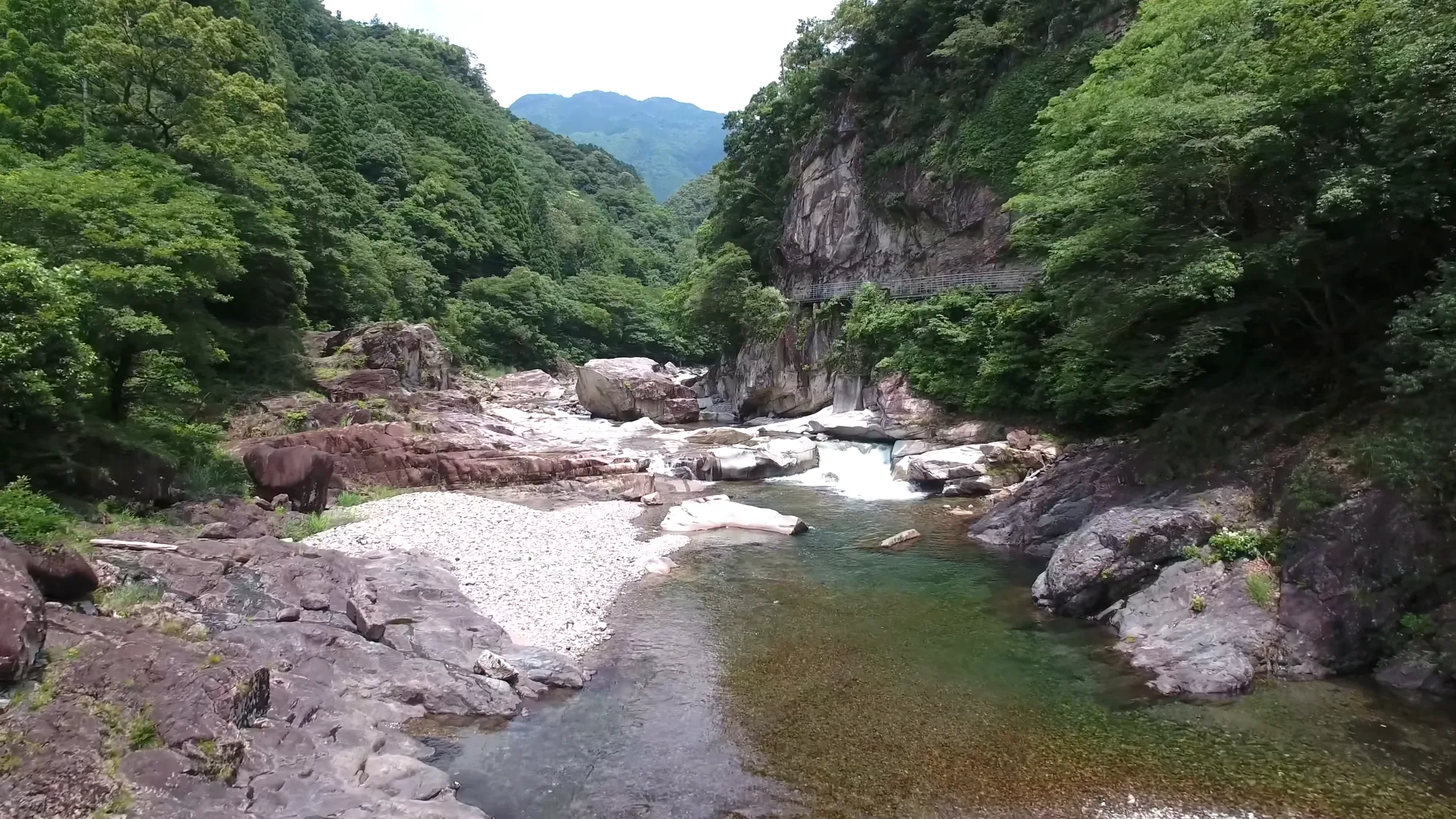
The Hinokage gorge, cut into the Kyushu highlands.
The Mitate path, and a ten-meter tunnel
The Mitate path is a loop. It starts at 水無平橋, a bridge beside the lodge 見立あけぼの荘, and the town gives it as 3.2 kilometers (2.0 miles) in about sixty minutes. It runs from 560 to 570 meters (1,837 to 1,870 feet), a difference of ten meters (33 feet), with an average grade of 0.5 percent.
There are rare plants, streams, and a hand-cut rock tunnel, and the autumn color is the thing. The tunnel is 晃岩トンネル, ten meters (33 feet) long. There is a mountain shrine, 水無平山神社, and a feature called 夫婦釜, the married pots.
The animals listed for this road are the giant dragonfly and the Genji firefly, with the brown-eared bulbul, the bush warbler and the white-eye. The surface is unpaved from the start to 夏木橋, Natsuki bridge, and paved from there back to the lodge.
The trolley line and its three tunnels
The Yahazu-dake trolley path is the long one, and the one with the most history. It opened in 1952 as a forest railway for a branch of the Takachiho forestry office, running between 鹿川 and 八戸.
Today it is 7 kilometers (4.3 miles) of gravel, about two hours one way from 八戸 to 中川, climbing from about 200 to 300 meters (656 to 984 feet). The town rates it intermediate, with an average grade of 1.4 percent. There is a toilet about an hour and a half along.
The town gives the start of this road two ways: a quiet walk along a flat mountain path from the pass at ゆすなみ峠 to the bridge at 中川橋, or a course running from 八戸 to 中川. The difference matters if you are arranging to be collected at the far end.
What makes it memorable is underground. There are three hand-cut rock tunnels, one of them about 50 meters (164 feet) long. Bring a flashlight.
The animals listed are the great purple emperor butterfly and the giant dragonfly, with the fox, the raccoon dog, the weasel and the marten. The trees are evergreen oaks, camphor, camellia, zelkova, pine, azalea, cedar, and hinoki.

The old Takachiho line crosses here. The trains stopped in 2005; the bridges remain.
The stone-wall village
The fourth road ends at a village built on walls. The trolley path to 石垣の村, the stone-wall village, starts at the town’s riverside campground and runs 2.5 kilometers (1.6 miles), about sixty minutes, from 175 to 194 meters (574 to 636 feet). The average grade is 0.8 percent, the steepest 3 percent, and the surface partly paved, partly gravel. The town says it is one of Japan’s hundred best walking paths.
At the end is Togawa (戸川). Its tallest wall is 11 meters (36 feet), the highest in Japan among stone walls built to make farmland. The walls went up from the Kaei era, beginning 1848, into the Ansei era, beginning 1854.
The animal list for this road is the longest of the four: the great purple emperor butterfly, the giant dragonfly and a second butterfly among the insects, and the badger, the fox, the raccoon dog, the weasel and the marten among the mammals. The trees add aoki, shikimi and ferns to the usual oaks and cedar. There is a rest stop where, the town says, a breathing program can be booked.
What lives along the roads
Put the four roads side by side and Hinokage has written down its wildlife road by road. Across them the town names two butterflies and a dragonfly, fireflies including the Genji firefly, five birds and five mammals.
They are not survey counts. They are the animals the town will tell you to watch for on each road.
The mountains above the town
The biosphere reserve has a name and a date. The 祖母・傾・大崩 area, across Ōita and Miyazaki, was approved on 15 June 2017.
At the core of those mountains is a protected national forest, and Hinokage is one of the towns it covers. It runs to 5,977.79 hectares (14,771 acres) between about 1,000 and 1,757 meters (3,281 and 5,764 feet), first set aside on 31 March 1976 and reorganized on 29 March 1990.
Its wildlife is worth knowing even though the therapy roads are far below it. A 2018 survey found eight species of mammal, with the Japanese serow by far the most numerous, and twenty-five bird species. It also found the Sobo salamander, listed as endangered under the Ministry of the Environment’s category IB and as a nationally rare species.

The line is walked now, not ridden.
None of these animals is listed on any of the town’s therapy roads, which run between about 175 and 570 meters (574 and 1,870 feet). They belong to the high country above the valley.
What the certificate measured
Certified bases sometimes publish the methods of their certification experiment; none publishes the results. Hinokage publishes neither.
The lunch, and the seasons left blank
The therapy bentō uses seasonal ingredients from the town: sweetfish, mountain trout, chestnuts and mountain vegetables.
The trees are cedar, hinoki and pine, with evergreen oak, chinquapin and sawtooth oak.
No seasonal calendar is published. The Mitate path is for autumn color, and fireflies are listed for the railway walk and the Mitate loop, without a month attached.
Where to sleep, and who to ask
There are three places to sleep. The first is the train inn beside the hot spring station (TR列車の宿), whose six rooms come in three types: rooms for four, twin rooms for two, and a single Japanese-style room. The second is 日之影キャンプ村, a riverside campground with bungalows, which is also where the stone-wall trolley path begins.
The third is 見立あけぼの荘, the lodge at the start of the Mitate loop, with a small open square beside it. Sleeping there puts the loop at the door.
Beyond the beds, the stone-wall village of Togawa is a destination in its own right.
Guided walks are arranged through the 日之影町森林セラピー推進協議会, the town’s forest therapy promotion council, which sits in the town office’s regional promotion section. The tourism association takes bookings through an application form. No price is published for a guided walk, so ask.

The serow is the animal these highlands are known for, and is rarely seen.
On wheels
The base accepts wheelchairs and strollers. The grade figures make that plausible on at least three roads, all averaging under one percent. They do not settle it.
Ask the town four things.
How wide is the surfaced part of the railway walk, in centimeters? Is there a step at 吾味 station, or at the start of the Mitate loop? What is the surface between the parking area and each trailhead? And is there an accessible toilet at the hot spring station or the lodge?
Two warnings are worth weighing. The railway walk is partly gravel. And the trolley path has tunnels dark enough to need a flashlight.
Getting there, and the shape of a day
The hot spring station is about 29 kilometers (18 miles) from the Nobeoka exit of the Nobeoka road, and parking is free. No bus route is published. The forest therapy contact is the town’s regional promotion section, on 0982-87-3801.
The railway walk’s address is Nanaori 8705-12, on 0982-78-1021. The hot spring station is on 0982-87-2690.
The shape of a stay assembles itself. Sleep in a railway car. Walk the old line in the morning, slowly, at a grade you will barely notice, and stop at the bridge from 1939 before the falls. In the afternoon, take the trolley path to the stone walls.
Then go back to the station that a typhoon closed and get into the water. The trains are gone. The forest that they ran through is still here, and it is the reason you came.
Nearby and alike

Miyazaki · Certified 2008
Nichinan
In Obi cedar country, a gorge of evergreen forest, seven waterfalls and about three hundred mosses, with a 51-degree spring after.

Kagoshima · Certified 2007
Kirishima
Japan’s first national park, stone-paved forest with two-hundred-year trees and wild deer, columnar basalt beside the shrine of the gods’ descent — and a guided walk, once a month, for eight hundred yen.

Ōita · Certified 2012
Ōita
Ten certified roads within an hour of Ōita, from a flat museum loop to a five-star ridge, with guides at ¥3,000 a group.

Origins
A forestry bureau named shinrin-yoku in 1982. The manners it asked for are older, and they are still kept.

Certification
Over sixty Japanese forests hold a therapy certificate. What the test involves, and what it does not promise.

Choosing a Base
Eight forests, from Kusatsu to Yakushima. Which fits your days, your season and the onsen waiting after.
Verified by The Japan Onsen Society
Sources
森林セラピーソサエティ「宮崎県 日之影町」— https://fo-society.jp/facility/miyazaki-hinokage/ (認定 2006年; all access fields 可; ~91% forest; 日之影川・綱の瀬川; 2015 世界農業遺産, 2017 ユネスコエコパーク; 6 roads, 2 described; bentō アユ・ヤマメ・栗・山菜; tree fields; seasons blank; guide message on flat roads; TR列車の宿, 日之影温泉駅, 日之影キャンプ村, 戸川 11 m; contact)
林野庁「森林セラピー基地・セラピーロード 第1期(平成17年度)認定箇所一覧」平成18年4月18日 — https://www.rinya.maff.go.jp/puresu/h18-4gatu/0418b2.pdf (six bases and four roads; 日之影町 entry and catchphrase; 遊歩百選に選ばれた平坦な道)
日之影町観光協会「森林セラピーガイド」and four road pages — https://hinokage-kanko.jp/therapyguide/ · tr · mitate · yahazu_dolly · ishigaki_dolly (distances, times, elevations, grades, surfaces; 1939 bridge; 45 m falls; 晃岩トンネル 10 m; trolley line 昭和27年; three tunnels ~50 m; 嘉永–安政 walls; per-road fauna and flora lists; addresses and phone)
たびんぐ「日之影温泉駅」— https://tabi-mag.jp/mz0250/ [CITABLE, secondary] (昭和14年10月11日 opened; 平成元年4月28日 to Takachiho Railway; 平成7年1月1日 hot spring; 平成17年9月6日 typhoon 14; 平成20年12月28日 closed; spring type; TR列車の宿 6 rooms; 29 km from Nobeoka IC; 0982-87-2690)
文部科学省「ユネスコエコパークの新規登録について」— https://www.mext.go.jp/unesco/001/2017/1386813.htm (平成29年6月15日; 祖母・傾・大崩)
林野庁九州森林管理局「祖母山・傾山・大崩山周辺森林生態系保護地域」— https://www.rinya.maff.go.jp/kyusyu/keikaku/hogorin/shinrin_seitaikei/sobokatamuki.html (includes 日之影町; 5,977.79 ha; ~1,000–1,757 m; 昭和51年3月31日 / 平成2年3月29日; 平成30年度 survey: 8 mammals, ニホンカモシカ most numerous; 25 birds; ソボサンショウウオ status)
Verified: 2026-10-05