Toyama · Certified 2009
Tateyama-sanroku Forest Therapy Base: Six Roads Across a Ski Area, Walked in the Green Season
A ski company’s summer: six forest roads over the Gokurakuzaka and Raichō Valley slopes, a level birch kilometer, cuckoos on the plateau, and a 200-meter water slide over rock.

Timber boardwalk crossing a russet alpine marsh scattered with small pools at Tateyama, Toyama
Step-free
Partly step-free
White birch path is flat; the others are not
The main road
Awasuno plateau
あわすの平をゆく道 · 10.8 km (6.7 mi) · about 120 min
Open
25 Apr – 3 Nov
Holiday village closes December to March
Nearest station
Tateyama
Toyama Chihō Railway, then 10 min by car
The record
What you need to go
Open season
Green season. The mountain cart ran 25 April to 3 November in 2026, and the holiday village closes from December to March
Getting there
Tateyama (立山駅) on the Toyama Chihō Railway, about 10 minutes by car to the holiday village. The ski area has 1,400 free parking spaces
Fees
Forest therapy with yoga is ¥3,500 (about $23), including a therapy lunch and a discount ticket for a hot spring. Other programs carry no published price
Onsen
Shirakaba no Yu (白樺の湯), running free from the source at the white birch flat, with Awasuno and Kamegai springs nearby
The walk
Main trail
The road across the Awasuno plateau (あわすの平をゆく道), 10.8 km (6.7 mi) in about 120 minutes one way, past a hot spring and two ski slopes
All trails
6 trails, 1 to 10.8 km (0.6 to 6.7 mi), 50 to 120 minutes, graded from beginner to advanced
The step-free road
Barrier-free is marked yes, and the white birch path is flat with zero height difference. The other five are not, and one climbs 250 m (820 ft)
The forest
Forest type
Six roads over the slopes of a winter resort below Tateyama, under peaks of 1,043 to 1,401 m (3,422 to 4,596 ft)
What grows
Mizunara oak dominant, with Erman’s birch, konara, bird cherry and chestnut, plus a white birch avenue and a cedar avenue
What lives
Japanese bush warbler, lesser cuckoo, gray wagtail and common cuckoo along the plateau road. Japanese serow in the area
Certified since
2009
All figures updated 5 October 2026
The forest, before the facts
In summer, the ski slopes at the foot of Tateyama are walked instead of skied. The company that runs them also runs the forest therapy base, and its six roads cross its own pistes: one goes up the Gokurakuzaka slope (極楽坂) for a view the company calls far beyond any other, one runs through fields of rapeseed and sunflowers on the Raichō Valley slope (らいちょうバレー), and one passes the ski jump.
The longest of them runs 10.8 kilometers (6.7 mi) across the Awasuno plateau (あわすの平), from Omi past the Kamegai hot spring (亀谷温泉) and a colony of katakuri to a family holiday village. Along it, the company says, you hear a chorus of small birds: the bush warbler, the lesser cuckoo, the gray wagtail, and the common cuckoo.
The forest in between is mostly mizunara oak, with Erman’s birch, konara, bird cherry and chestnut. Above it are peaks of 1,043 to 1,401 meters (3,422 to 4,596 ft). It is a mountain base built on a winter resort, and in the green months the resort becomes the forest’s way in.
Five reasons to come
Six roads laid across the slopes of a working ski area.
A level kilometer (0.6 mi) under white birch, for beginners.
Bush warblers, cuckoos and wagtails along the 10.8-kilometer (6.7 mi) plateau road.
A 200-meter (656 ft) water slide over bare rock, below a 40-meter (131 ft) waterfall.
Three hot springs, Tateyama-sanroku, Kamegai, and Awasuno.
A ski area, in summer
The operator is Ōyama Kankō Kaihatsu (大山観光開発㈱), and its sales department. The company’s own site is the ski area’s site, and its forest therapy page sits beside pages for trekking and a mountain cart.
The ski area’s longest run is about 3,000 meters (9,843 ft) and its steepest slope 32 degrees, with four pair lifts and a kids’ park in the Raichō Valley area, and quad and pair lifts and a free sledding area at Gokurakuzaka.
There is parking for 1,400 cars, free, at Raichō Valley, and 1,200, also free, at Gokurakuzaka.

Tateyama cedar, which grows slow and crooked under four meters of snow a year.
So Tateyama-sanroku is a certified forest laid over somebody else’s works, of a kind you will not find anywhere else in the scheme: not a railway, a mine or a temple, but a ski resort. Its roads use the resort’s own slopes and parking lots.
The slope in summer
The mountain carts state the arrangement plainly. They have no engine, and you steer and brake them downhill on the Gokurakuzaka area, which is a ski slope in winter. The course is about 650 to 800 meters (2,133 to 2,625 ft), and the 2026 season runs from 25 April to 3 November.
A ride costs ¥1,500 (about $10), or ¥3,500 (about $23) for three. That is the green-season business the forest therapy roads belong to. The wind path starts below the same slope.
Six roads
The company’s page names six roads, A to F.
A, the white birch path (白樺の小径), is for beginners: a flat kilometer (0.6 mi) out and back under a fine avenue of white birch, about fifty minutes with time to look around. B, the road across the Awasuno plateau (あわすの平をゆく道), is intermediate, about 120 minutes one way.
C, the wind path (風の小径), is advanced, about 110 minutes, from below the Gokurakuzaka slope across the plateau to the top of Mount Gokurakuzaka. D, the flower path (花の小径), is intermediate, about 100 minutes, through the flower fields on the Raichō Valley slope.
E, the clear stream and forest path (清流と森の小径), is beginner to intermediate, about 90 minutes, with a cedar avenue and katakuri. F, the Ōshina mountain nature trail (大品山自然歩道), is advanced, and can be walked in any season.
For beginners and the experienced
The official line is brief. Across the foot of Tateyama, therapy roads have been laid out where you can walk in the forest and be soothed, with a variety of courses for everyone from beginners to experienced walkers.
And all four service answers are yes: corporate training, visitors from abroad, children, and barrier-free access.

Foothill beech, which turns a fortnight after the alpine route has already gone over.
Two sets of figures
The Society describes three of the six roads with distances. The white birch path: 1,000 meters (3,281 ft), 60 minutes including time to look around, with a height difference of zero. The clear stream and forest path: 3,000 meters (1.9 mi), 90 minutes, plus or minus 250 meters (820 ft).
The Awasuno plateau road: 10,800 meters (6.7 mi), 120 minutes, plus or minus 100 meters (328 ft). The company gives the same road as about 120 minutes one way, start to finish.
For the white birch path the two disagree slightly: 60 minutes from the Society, about 50 from the company. Allow for either.
The plateau road
The description of road B is a list of places, and it reads like a map of the area. It runs from Omi (小見), past the Kamegai hot spring, the Akasakadaira and Shirakabadaira flats, the ski jump, the Gokurakuzaka ski slope, a colony of katakuri, the Raichō Valley ski slope, and on to the Tateyama-sanroku family holiday village (立山山麓家族旅行村).
Akasakadaira runs through a gradient of greens from spring into summer, and turns red in autumn.
It is the road that shows the base most completely: a hot spring, two ski slopes, a jump, a wildflower colony, and a holiday village, joined by forest.
What lives here
Four birds are named along the plateau road: the Japanese bush warbler, the lesser cuckoo, the gray wagtail and the common cuckoo, in what the company calls a chorus of small birds.
Plants get named on the other roads: the golden-rayed lily, growing in colonies on the wind path; katakuri on the plateau road and the clear stream path; and the snow camellia, with katakuri in spring, on the Ōshina trail.
The forest itself is mostly mizunara, with Erman’s birch, konara, bird cherry and chestnut. The Japanese serow turns up too, mentioned in connection with the area’s hot springs rather than with any particular road.

Late October at 600 meters, which is where the certified base actually sits.
The water
There are two features of water worth the detour. The Dragon God Falls (龍神の滝) drops 40 meters (131 ft) in the upper reaches of the Ushikubi valley (牛首谷). Below it, for about 200 meters (656 ft), the stream runs smoothly over bare rock in what is called the hundred-ken slide (百閒滑).
The clear stream and forest path leads from the family holiday village along the city road to the Awasuno ski area, and then on to the slide. Two spellings of its name are in circulation, 百間滑 and 百閒滑, so expect either one on a sign.
The mountains above
The peaks the trails climb toward: Mount Ōshina (大品山) at 1,401 meters (4,596 ft), Mount Setokura (瀬戸蔵山) at 1,320 meters (4,331 ft), and Mount Gokurakuzaka (極楽坂山) at 1,043 meters (3,422 ft). The Chūbu-Hokuriku nature trail passes through.
The trekking goes higher. There is a Mount Kuwasaki climb (鍬崎山) of 16 kilometers (9.9 mi) taking about twelve and a half hours, for strong walkers, and an Ōshina course of 12 kilometers (7.5 mi) out and back, about seven and a half hours. Those are hikes, not therapy roads, and they start from the same ski area.
There is also a loop from the rural exchange center, over the top of the Gokurakuzaka slope and Mount Setokura to the Dragon God Falls and back, about 10 kilometers (6.2 mi) in about six and a half hours, and a beginner course of 8 kilometers (5.0 mi) over Mount Gokurakuzaka and the white birch flat, about four and a half hours.
And three walking courses, A, B and C, of about 5, 10 and 13 kilometers (3.1, 6.2 and 8.1 mi), from about an hour to four hours. With the six therapy roads, that is a dense web of paths for one ski area.
On wheels
The Society’s barrier-free answer for Tateyama-sanroku is yes. Its own road description gives the white birch path a height difference of zero, and the company calls the path flat. For once, the two agree.
It is still not the answer. Ask the company four things about the white birch path. How wide is it, in centimeters? Is there a step at the start?
What is the surface between the parking area and the path? And is there an accessible toilet nearby?
The other five roads are not flat. The clear stream path has 250 meters (820 ft) of height difference, and the wind path and the Ōshina trail are both marked advanced.
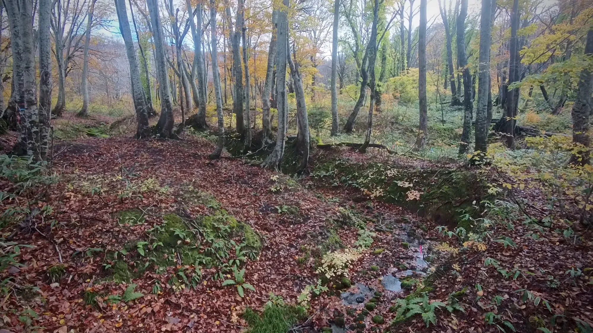
Snow-country beech, bent at the base from decades of being buried.
The plan and its price
There is one published plan, forest therapy and yoga, at ¥3,500 (about $23), including a therapy lunch and a discount ticket for a hot spring. There is no separate therapy bentō.
Optional programs include forest therapy yoga, Nordic walking, glass craft and pottery. No prices are published for any of them, and the therapy lunch has to be booked ahead. Bookings go by phone, email, the web form, or postcard, ten days in advance.
Proven, by whose account
The city’s tourism leaflet goes further than the company. It says that in July 2008 verification was carried out at Tateyama-sanroku, that the forest therapy courses were shown to produce a relaxing effect and a stress-relieving effect on physiological measures, and that the base was certified in 2009.
That gives the month of the certification experiment. It does not give the number of people, the measures, the comparison, or any figure at all. The word it uses means demonstrated, and the demonstration is nowhere to be found.
So take the date and leave the claim. Methods are sometimes published; results never are. Here a date is published and the result is asserted without its numbers.
What the company claims
The company says that phytoncides have a relaxing effect. It cites nothing for it, and neither do we.
The guides’ own message goes further still. After an invitation to breathe deeply, listen to the stream and the wind, and touch the damp earth and rough bark, it says that people once lived in nature, that we now live in artificial surroundings under daily stress, and that the tired and wounded heart, and every single cell, can be healed by forest therapy.
Those are the guides’ words, not ours. Nobody has offered a study for them, and a walk in the woods is not a course of treatment.
And no method and no result from the certification experiment is published anywhere.

The floor is only clear for about five months of the year.
Who runs it, and what that means
The operator type here is a private company, and specifically a ski-area company. Forest therapy is one of its green-season products, alongside trekking, a mountain cart, crafts, and events.
The implication is direct. A ski company has every reason to fill its slopes and parking lots in summer, and the infrastructure, lifts, parking, staff, and access roads, is already there. The base’s future is tied to the ski area’s.
The certification year is 2009, which the city and the Society agree on.
The hot springs
There are three hot springs, each with different water: Tateyama-sanroku (立山山麓温泉), Kamegai (亀谷温泉) and Awasuno (粟巣野温泉). The plateau road passes Kamegai, and the yoga plan’s discount ticket is for a bath.
A bath after the birches
The description of the white birch path ends with an invitation: after the forest bathing at Shirakabadaira, the white birch flat, try the natural hot spring at Shirakaba no Yu (白樺の湯), the white birch bath, which runs free-flowing.
The clear stream path has two more hot springs near it, Awasuno and Tateyama-sanroku, which warmly soothe a walker’s tiredness. And there is a mention somewhere of meeting a serow while sitting in the bath, which is the closest anybody comes to naming a large mammal here.
Winter, for comparison
In December 2020 the city announced the ski season opening on the 12th, with day skiing from 8:00 to 16:10 and night skiing from 16:00 to 21:00, on slopes called Utopia, Paradise and Family, and parking free.
That is the other half of the year at this base. The slopes the therapy roads cross in summer are lit for night skiing in winter, and the company that runs one runs the other.
A pilgrim’s mountain
There are also walks here that are not forest therapy. One, announced for 25 July 2026, is called Tateyama faith trekking (立山信仰トレッキング), on the Mount Raihai course (来拝山) — a name that means the mountain of coming to worship.

The low track through the foothills, flat and soft and easy to walk slowly.
Another, for 8 August, invites people on an evening walk with stargazing.
The name ties the mountains above the ski area to the worship of Tateyama. Nothing published describes the course or its history, so ask the company what the walk actually covers.
Getting there
The company’s address is 55 Hara, Toyama city (富山県富山市原55). It gives no drive time from the expressway and no rail connection.
The family holiday village where two of the roads end gives both: about 30 minutes by car from the Tateyama exit of the Hokuriku Expressway, and about ten minutes by car from Tateyama station (立山駅) on the Toyama Chihō Railway. Parking for 100 cars.
The holiday village
The holiday village is a campground surrounded by the mountain’s nature, with an economy campground, an auto campground, and cottages. Prices start from ¥1,050 (about $7) for an economy site to ¥5,230 (about $35) for an auto site and ¥12,450 (about $83) for a cottage.
The village is open every day but closed from December to March, with bookings taken from 9:00 to 17:00. Anyone who wants to sleep at the end of the plateau road should come between April and November; in winter the slopes belong to the skiers.
The shape of a visit
Come in the green season, for the birds the company names on the plateau and the flower fields on the Raichō Valley slope. Walk the white birch kilometer first, slowly.
Then take the plateau road with a guide, from the Kamegai hot spring toward the holiday village, past the ski jump, and listen for the cuckoos.
Finish at the hundred-ken slide, where the water runs over the rock below the dragon god falls.
Nearby and alike

Toyama · Certified 2012
Kamiichi (Tsurugi Kirameki no Mori)
Three areas below Mount Tsurugi: a fir avenue planted for Ryūsenji in the 1600s, a rock-carved Fudō at Nissekiji, and thousand-year Tateyama cedars at the climbers’ base.

Niigata · Certified 2008
Myōkō
Six roads across four highlands below Mount Myōkō, from the Sasagamine plateau at 1,300 meters to a hillside of Yayoi houses, burial mounds and a sixteenth-century castle.

Ishikawa · Certified 2013
Tsubata (Ishikawa Prefectural Forest Park)
Five therapy roads, one barrier-free, in Ishikawa’s prefectural forest park above Kanazawa, with a vermilion bridge, a new protection zone for migrating birds, and the Kurikara pass nearby.

Certification
Over sixty Japanese forests hold a therapy certificate. What the test involves, and what it does not promise.

Choosing a Base
Eight forests, from Kusatsu to Yakushima. Which fits your days, your season and the onsen waiting after.

Forest and Onsen
Two old Japanese ways of resting the body meet in the Kiso valley. Cypress air, hot water, and what is known.
Verified by The Japan Onsen Society
Sources
森林セラピーソサエティ「富山県 立山山麓森林セラピー基地」— https://fo-society.jp/facility/toyama-tateyama/ (認定 2009年; all acceptance fields 可; 6 roads, 3 described with m / min / ± figures; tree and season fields blank; plan ¥3,500 with lunch and onsen ticket; bentō 無; guide message incl. “細胞の一つ一つも、森林セラピーで癒すことができます”; 白樺の湯, あわすの温泉, 立山山麓温泉; intro; operator)
大山観光開発 — therapy · trekking · cart · news (roads A–F with times and features; birds ウグイス, ホトトギス, キセキレイ, カッコウ; ヤマユリ, カタクリ, ユキツバキ; parking 1,400 / 1,200; phytoncide claim; programs; booking; trekking and walking courses; cart on the winter ski slope, 650–800 m, ¥1,500; 立山信仰トレッキング 来拝山 25 July 2026; stargazing walk)
富山市観光協会 leaflet (undated) — https://www.toyamashi-kankoukyoukai.jp/file_upload/102119/_main/102119_79.pdf (peaks 1,401 / 1,320 / 1,043 m; 龍神の滝 40 m; 百閒滑 200 m; ミズナラ forest composition; three hot springs; カモシカ; 2008年7月 verification, effects “実証”, 2009 certification)
富山県 スポーツ施設 (ski) — https://www.pref.toyama.jp/shared/site_sportslink/documents/ski.pdf (longest ~3,000 m; max 32°; lifts)
富山市 広報 令和2年12月5日 — https://www.city.toyama.lg.jp/res/projects/default_project/_page/001/002/865/kouhou0376-p08-09.pdf (ski opening 12 Dec; day and night hours; gelände names; free parking)
るるぶ「立山山麓家族旅行村」— https://rurubu.jp/andmore/spot/80015655 [CITABLE, secondary] (campground types and prices; 立山駅 10 min; 立山IC 30 min; 100 spaces; closed Dec–Mar)
Verified: 2026-10-05