Okayama · Certified 2008
Shinjo Forest Therapy Base: A Cradle Path Through a Beech Forest That Grew Back When the Iron Furnaces Stopped
Hammocks on a two-kilometer path at the foot of Mount Kenashi, a paved loop around a power company’s dam, and an old post town on the iron road.

Clear stream running over mossy boulders beneath a small timber footbridge in green forest at Shinjo, Okayama
Step-free
Step-free
Doyō dam loop is asphalt the whole way
The main road
Cradle path
ゆりかごの小径 · about 2 km (1.2 mi)
Open
Year-round
Untrodden snow in winter
The record
What you need to go
Open season
Open year round. New green from a hammock in spring, water sparkling at the source in summer, color in autumn, snow nobody walks into in winter
Getting there
No station or bus route published. About 20 minutes by car from the Hiruzen interchange on the Yonago Expressway, with 25 parking spaces
Fees
A two and a half hour guided walk is ¥6,000 (about $40) per guide plus ¥500 (about $3) a head, up to six per guide, booked a week ahead. Bentō for two or more, ordered two weeks ahead, price not published
Onsen
not published
The walk
Main trail
The cradle path (ゆりかごの小径), about 2 km (1.2 mi) at the foot of Mount Kenashi, with hammocks slung along it
All trails
2 trails. The cradle path runs about 2 km (1.2 mi) with about 50 m (164 ft) of height difference; the lakeside loop is unmeasured
The step-free road
The lakeside loop around the Doyō dam is asphalt the whole way, and the base recommends it for wheelchairs and stretchers. No width or toilet is published
The forest
Forest type
A 296 ha (731 acre) beech forest from 720 to 1,218 m (2,362 to 3,996 ft), above the smallest village in Okayama by population
What grows
Beech about a hundred years old · Horse chestnut · Mizunara oak · Cedar · Hinoki cypress. The forest is 74 percent natural
What lives
Not published for the roads. Katakuri on the ridge trail, and the village as a whole holds giant salamanders and two rare butterflies
Certified since
2008
All figures updated 5 October 2026
The forest, before the facts
For a long time the forests around Shinjo were fuel. The Forestry Agency’s own entry for the beech forest on Mount Kenashi (毛無山) says so: the whole area was given over early to tatara iron-making, and much of the forest was cut for the firewood and charcoal the furnaces needed. When the iron-making declined, the cutting stopped. The beech and cedar grew back on their own.
That is the forest the guides walk you into now, at the foot of the mountain, on a path of about two kilometers (1.2 miles) that the Society says has only about 50 meters (164 feet) of height difference. Along the way there are hammocks. The Society’s description of the road says that if you let one of them rock you, it is as if the forest is holding you, and the road’s name is the cradle path (ゆりかごの小径).
The village is the smallest in Okayama by population, the Society says, and it belongs to a group that calls itself the most beautiful villages in Japan. Its main street is an old post town on the road the iron was carried along, lined with 132 cherry trees planted to celebrate a war. Much of what you see here was first built for something else.
Five reasons to come
A two-kilometer cradle path with hammocks, under a beech forest that regrew itself.
A fully paved loop around a dam lake, recommended for wheelchairs and stretchers.
A guide for up to six people, at ¥6,000 (about $40) plus ¥500 (about $3) a head.
An old post town on the iron road, with 132 cherry trees from 1906.
Snow in winter that, the Society says, no one walks into.
Fuel, then forest
The Forestry Agency includes the beech forest on Mount Kenashi among its hundred selected source-water forests. Its entry, number 73, locates the forest at Tanami in Shinjo village (新庄村田浪) and gives it an area of 296 hectares (731 acres), from 720 to 1,218 meters (2,362 to 3,996 feet) above sea level.
It gives the forest’s makeup as 26 percent planted and 74 percent natural, 45 percent conifer and 55 percent broadleaf, with beech, cedar, and hinoki as the main trees. And it gives the history plainly. The Shinjo area, it says, was a center of tatara iron-making from early on, and much of its forest was used for the firewood and charcoal that iron-making needed; as that industry declined, the cutting stopped, and natural forests of beech and cedar formed afterward.
The agency calls the result a natural beech forest of around a hundred years in age, with good stream habitat and a great variety of plants and animals. Its entry adds, in so many words, that the forest is now a forest therapy base.

Snow country forest, which is why nothing here grows quite straight.
That makes Shinjo another case of a certified forest laid over somebody else’s older works. Here the older work was iron, and the forest is what grew back when the furnaces went cold.
Who owns the mountain
The same entry has a second history, about ownership. Part of the forest is still company-owned, it says, but to keep the natural forest for later generations, Okayama Prefecture bought about 264 hectares (652 acres) into public ownership, in 1993, 1995 and 2002.
It also lists what the forest’s water does downstream. It is the source of the Shinjo river (新庄川), a headwater of the Asahi river system, and the agency says the water serves drinking supply, farm irrigation, fish farming, and hydroelectric power.
Okayama’s tourism site adds that Mount Kenashi stands on the border with Tottori, at 1,218 meters (3,996 feet), with about 500 meters (1,640 feet) of climb from its foot. It says the trail passes century-old beech and natural cedar, and that from the summit you can see Daisen, the three peaks of Hiruzen, and the Yumigahama shore.
Largest, by whose count
Three sources describe the size of the beech forest, and they do not use the same yardstick. Okayama’s tourism site, describing the cradle path, says Mount Kenashi is known for the largest natural beech forest in the prefecture. The prefectural grassland document calls it one of the largest beech forests said to exist in the whole Chūgoku region.
The council’s own site places the cradle path at the foot of Mount Kenashi in Daisen-Oki National Park (大山隠岐国立公園), and the prefectural document gives the mountain as a special protection zone of that park. Neither source gives the zone’s boundaries, and neither puts the cradle path inside it.
Each of those claims belongs to whoever made it. The Society itself makes none.
Two heights for one summit
The Society gives Mount Kenashi as 1,219 meters (3,999 feet). The Forestry Agency gives the top of its beech forest as 1,218 meters (3,996 feet), and Okayama’s tourism site gives the mountain’s height as the same. The two figures are one meter apart, which will not trouble your legs.
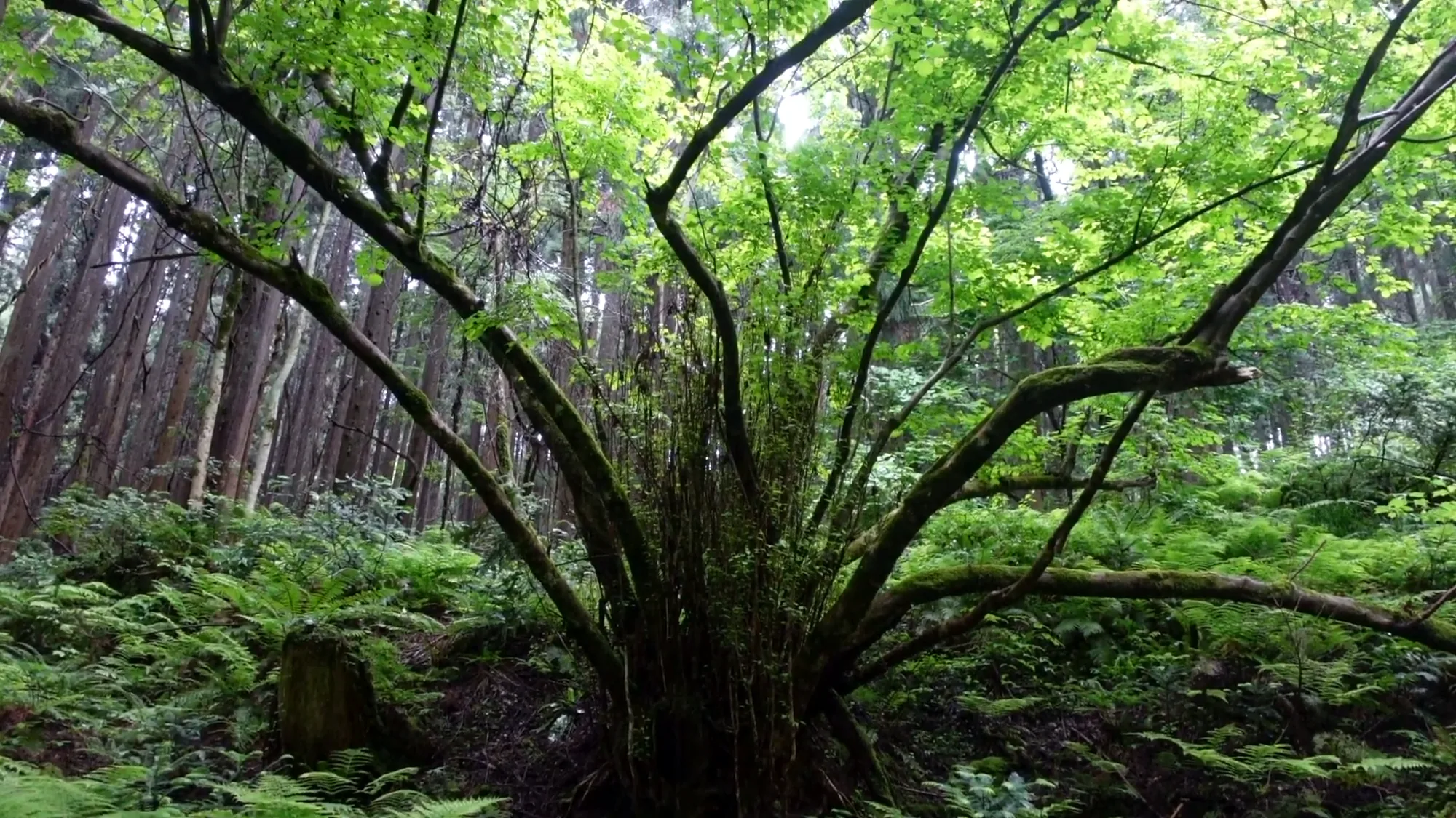
One broadleaf holding its ground in the middle of a plantation.
The therapy roads are well below the summit, at the mountain’s foot. Neither the Society nor the operator gives their elevation.
A village of 772
The village’s own figures make the Society’s point about size concrete. A 2025 brochure from Shinjo village, inviting corporate hometown-tax donations, gives the population as 772 people as of 1 February 2025.
The same brochure dates the village’s membership of the most-beautiful-villages group to 2011. It describes the cherry avenue as more than 130 Somei-Yoshino trees planted in 1906, and says the street has been chosen for two national lists of a hundred: one for soundscapes, and one for scents.
The brochure says more than 130 trees; a travel guide counts 132. Those do not conflict, and the brochure is a fundraising document, which is worth knowing when you read its superlatives.
Two roads
The Society lists two roads. The first, the cradle path, is about two kilometers (1.2 miles) long with about 50 meters (164 feet) of height difference, and the Society calls it a gentle road. The hammocks are on it.
The second, the lakeside path (湖畔の小径), is the loop around the Doyō dam (土用ダム). The Society says the whole route is asphalt and recommends it for people using wheelchairs or stretchers. It does not give a length or a time.
Okayama’s tourism site describes the dam as an 86.7-meter (284-foot) rockfill dam built by Chugoku Electric Power for hydroelectric generation, the largest of that company’s hydroelectric plants. It says a loop path has been built around it, where visitors can come into contact with rare nature.
The council’s own site gives the dam’s output as up to 1.2 million kilowatts. It does not say whether that is the dam alone or a larger scheme it belongs to.
So the second road is a power company’s dam road. That is worth knowing.

Everything on this slope is wet from April to November.
On wheels
The Society’s barrier-free field for Shinjo is positive, and here, unusually, the road description backs it up. The lakeside path is asphalt all the way, the Society says, and it names wheelchairs and stretchers outright.
That is still not an answer. Ask the council four things. How wide is the asphalt on the lakeside loop, in centimeters? Is there a step or curb where it starts?
What is the surface between the parking area and the start of the loop? And is there an accessible toilet at the dam or at the cradle path’s parking area? None of this is published.
The cradle path is a different matter. The Society calls it gentle, but it is a forest path with 50 meters (164 feet) of climb, and nobody publishes its surface.
The guide and the price
The Society publishes one plan, the cradle path plan: two and a half hours, at ¥6,000 (about $40) per guide plus ¥500 (about $3) per participant. Okayama’s tourism site gives the same price, and adds that one guide takes up to six people and that the walk runs from 10:00 to 12:30.
So a party of six pays ¥9,000 (about $60) in all, or ¥1,500 (about $10) each.
Book a week ahead, the tourism site says, by phone or through the online form on the council’s site. The council’s line is 0867-44-1330, staffed on weekdays from 9:00 to 16:00, according to the tourism site.
The council’s own site says the same thing more simply: book through the form, or by phone or fax, and walk with one of the forest guides.
The lunch
The Society says there is a therapy bentō, ordered for two or more, and describes it as a carefully made lunch full of the village’s natural produce. The tourism site adds that it must be ordered two weeks in advance.

New growth, which is the only thing with any light on it down here.
No price is published.
Who runs it, and what that means
The Society lists the operator as the Shinjo village forest therapy council (新庄村森林セラピー協議会). The council’s site lists its forest guides by name, with a chairman at the top, and calls them guides of the forest (森の案内人). It does not say who sits on the council or which office runs its secretariat.
That makes the operator type a village council working with named resident guides, rather than a town office section or a company. The implication is direct. A base like this depends on the people who live there, in a village the Society calls the least populous in the prefecture. Its strength is that the guides are local; its risk is that there are not many of them, and nothing published says who replaces them.
The guide message is the council’s pitch, and it is a good one. Shinjo, it says, is a place where you can see no man-made buildings and hear no man-made sounds, where you can have the time and the space to yourself.
What lives here
The Forestry Agency says the beech forest supports a great variety of plants and animals, without naming them. The council’s own site calls the foot of the mountain a treasure-house of rare plants and animals, also without names. The tourism site’s description of the cradle path adds the sound of the stream and of small birds.
Okayama’s tourism site names one flower, katakuri, the dogtooth violet, seen on the ridge trail from Mount Kenashi toward the neighboring summit (白馬山). That is on the hiking trail, not on a therapy road.
A prefectural document on grassland conservation and wetland restoration in Shinjo names more, for the wider village rather than the roads: the giant salamander (オオサンショウウオ); three plants, pasqueflower (オキナグサ), a broomrape (オオナンバンギセル) and a ragwort (ハンゴンソウ); and two butterflies, the silver-studded blue (ヒメシジミ) and a fritillary (ウスイロヒョウモンモドキ). It gives the last of these as critically endangered on the Ministry of the Environment’s 2020 Red List, and names a local nature conservation council working with the village. Those belong to the village as a whole, not to the therapy roads.
The waterfall
The council’s site lists two more places beyond the roads. One is the dam. The other is Fudō falls (不動滝), which it gives as 40 meters (131 feet) high, with a plunge pool about 35 meters (115 feet) across and 27 meters (89 feet) long, of unknown depth.
The site attaches a folk tale to the falls, about a figure it calls Princess Omaru (おまる姫), and mentions a tradition of festivals at the falls. It does not tell the tale in full, so ask your guide for it.

The cradle path starts here, and goes up.
The falls are not on a certified road. They are on the council’s own list, which is reason enough to ask.
The trees the Society chose
The Society’s tree fields list cedar and hinoki as the conifers, and beech, horse chestnut, and mizunara oak as the broadleaves. Its special-tree field lists not a tree but an avenue: the victory cherry avenue (がいせん桜並木) in the village.
That is the Society’s way of pointing visitors down the hill, to the street the cherries line.
The victory cherries
A travel guide to the village says the cherries were planted in 1906 to celebrate victory in the Russo-Japanese War. It counts 132 trees, at intervals of 5.5 meters (18 feet), along the main street of the old post town of Shinjō-juku (新庄宿).
The same guide says the festival for the cherries (がいせん桜まつり) is the last cherry festival of the season in Okayama, held most years on a Sunday in mid-April. The Society’s seasonal fields do not mention it; its spring is new leaves seen from a hammock.
The name is not subtle. Gaisen is the word for a triumphal return. It is a war memorial that flowers.
The iron road
The travel guide describes the old post town in a little more detail. Shinjō-juku sat at the foot of the forty-bend pass (四十曲峠), which it calls the hardest point on the Izumo road (出雲街道). Daimyo from the San’in coast, among them the lords of Matsue, passed through on their journeys to and from Edo.
It also says that the seven post towns of Mimasaka on the Izumo road prospered as the route that carried iron made by tatara smelting in Izumo. That puts the village’s two histories side by side: the forest above was burned to make iron, and the road below carried iron away.

The avenue was planted in 1906 and the trees have not been replaced since.
The Society lists two buildings on that street among its nearby facilities. One is the house that served as the post town’s secondary official inn (木代邸). The other is an inn on the cherry avenue (須貝邸) that the Society says takes only two groups at a time.
The seasons
The Society’s seasonal fields are written like captions. Spring is new green seen from a hammock. Summer is the sparkle of water at the river’s source. Autumn is color, again from the hammock.
Winter is a field of snow that, the Society says, no one walks into. The tourism site gives the walks as year-round, and does not say whether the cradle path can be walked in snow. Ask before a winter visit.
Getting there
Okayama’s tourism site gives about twenty minutes by car from the Hiruzen interchange, 蒜山IC on the Yonago Expressway, with 25 parking spaces. The travel guide places the cherry avenue about 15 kilometers (9 miles) from the same exit.
The Society lists the roadside station (道の駅「がいせん桜新庄宿」), which it says was renamed and reopened in 2018, and which serves as the village’s local shop as well as a seller of its specialties.
The Society’s answer on visitors from abroad is no. A visitor without Japanese should ask in advance what language the walk will be in.
The shape of a visit
Drive in from Hiruzen in the morning and walk the cradle path with a guide, ten until half past twelve. Lie in a hammock longer than seems reasonable.
Eat the bentō, if you ordered it two weeks ago. In the afternoon, if anyone in your party walks with wheels, go around the dam lake on the asphalt loop.
Then go down to the old post town and walk under the cherries, in April if you can, past the secondary inn and the iron road. The forest above you grew back when the furnaces stopped. The street below you was built to carry what they made.
Nearby and alike

Shimane · Certified 2007
Iinan (Furusato no Mori)
Four short courses in a working highland forest at about 450 meters, one of them through rows of shiitake logs, with a protected wetland nearby.

Hiroshima · Certified 2013
Jinsekikōgen
A 2.2-kilometer lakeside path in the Taishaku gorge that the Society says a wheelchair can use, despite its own negative field, plus therapy dogs when the mountain area reopens.

Hiroshima · Certified 2012
Akiota
A gorge the prefecture protects for what may be its last preserved hinoki stand, a long-grazed grassy summit, Sandankyo by boat, and a lunch that always has beans.

Choosing a Base
Eight forests, from Kusatsu to Yakushima. Which fits your days, your season and the onsen waiting after.

Certification
Over sixty Japanese forests hold a therapy certificate. What the test involves, and what it does not promise.

Origins
A forestry bureau named shinrin-yoku in 1982. The manners it asked for are older, and they are still kept.
Verified by The Japan Onsen Society
Sources
森林セラピーソサエティ「岡山県 新庄村森林セラピー基地」— https://fo-society.jp/facility/okayama/ (認定 2008年; barrier-free 可, inbound 否; 毛無山 1,219m; 2 roads, ゆりかごの小径 ~2 km / ~50 m, hammocks; 湖畔の小径 土用ダム周回路, 全ルートアスファルト, 車いす・ストレッチャー; tree fields; seasons; plan ¥6,000 + ¥500/人, 2 h 30 min; bentō 2個から; 道の駅 2018, 須貝邸, 木代邸; guide message; least populous village; 日本で最も美しい村; contact)
新庄村森林セラピー協議会 — http://www.yurikagonokomichi.jp/ (2 km path at foot of 毛無山 in 大山隠岐国立公園; 希少な動植物の宝庫; 森の案内人 listed by name; booking by form/phone/fax; 不動滝 40 m, pool 35 × 27 m; 土用ダム 86.7 m, 最大120万kW)
林野庁「水源の森百選 73 毛無山ブナ林」— https://www.rinya.maff.go.jp/j/suigen/hyakusen/indivisual/260224_11.html (新庄村田浪; 296 ha; 720–1,218 m; 人工林26%/天然林74%; 針葉樹45%/広葉樹55%; たたら製鉄 → 薪炭材 → 天然林; 平成5・7・14年 ~264 ha 公有化; 新庄川源流, 旭川; ~100-year beech; “森林セラピーの基地”)
おかやま観光ネット — ゆりかごの小径 · 毛無山 · 土用ダム (県下最大のブナ自然林; ¥6,000 + ¥500, 6 per guide, 1 week ahead; 10:00–12:30; bentō 2 weeks ahead; 通年; 蒜山IC ~20 min; 25 spaces; 1,218 m, ~500 m climb, views; カタクリ on 白馬山 ridge; dam 86.7 m rockfill, 中国電力, largest of its hydro plants, 周遊路)
たびんぐ「がいせん桜通り」— https://tabi-mag.jp/ok0248 [CITABLE, secondary] (明治39年, 日露戦争戦勝記念; 132 trees at 5.5 m; 新庄宿, 四十曲峠, 松江藩参勤交代; 美作七宿 iron route; festival mid-April; 蒜山IC ~15 km)
新庄村「企業版ふるさと納税のご案内」(2025) — https://www.chisou.go.jp/tiiki/tiikisaisei/portal/pdf/dai45/B14_shinjyoson.pdf (772 people R7.2.1; 美しい村 2011 H23; 130本超 ソメイヨシノ, 1906; 音風景百選, かおり風景百選)
岡山県「草原の保全活動と湿地の再生活動」(undated) — https://www.pref.okayama.jp/uploaded/life/736887_6730644_misc.pdf (毛無山 大山隠岐国立公園特別保護地区; 中国地方最大級のブナ林; village species: オオサンショウウオ, オキナグサ, オオナンバンギセル, ヒメシジミ, ハンゴンソウ, ウスイロヒョウモンモドキ (環境省RL2020 IA); 新庄自然保護連絡協議会)
Verified: 2026-10-05